


As the monsoon intensifies over the southern parts of India, the India Meteorological Department (IMD) has issued a fresh weather warning for Andhra Pradesh. The state is expected to witness heavy thunderstorms, lightning, and isolated heavy rainfall over the next five days. With many districts already experiencing sporadic showers and stormy conditions, this latest advisory urges residents to remain alert and take necessary precautions.
In this blog, we’ll cover the IMD forecast details, affected regions, potential impact on daily life, safety measures, and what residents can expect over the coming days.
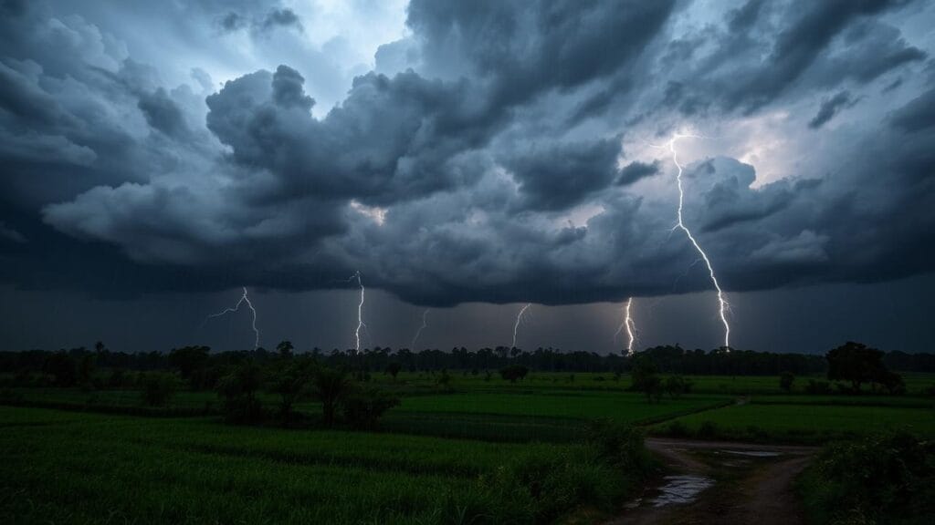
Weather Overview: Monsoon Gains Momentum
The southwest monsoon, which officially entered Andhra Pradesh earlier this month, is now gaining momentum due to favorable atmospheric conditions over the Bay of Bengal. The IMD has noted the development of strong cumulonimbus clouds, responsible for thunderstorms and heavy rain, over several coastal and interior regions of the state.
Meteorologists have highlighted an active monsoon trough and the presence of a low-pressure system over the Bay of Bengal as key reasons for the intensification of rain and thunderstorms across Andhra Pradesh.
Regions Likely to be Affected
The IMD’s five-day forecast, starting from June 28, indicates that both coastal Andhra Pradesh and Rayalaseema regions will be affected.
Coastal Andhra Pradesh
Districts such as Visakhapatnam, Srikakulam, Vizianagaram, East Godavari, West Godavari, Krishna, and Guntur are expected to experience moderate to heavy rainfall, accompanied by lightning and gusty winds.
Rayalaseema Region
Areas like Chittoor, Kadapa, Anantapur, and Kurnool may also receive scattered thunderstorms and localized downpours.
High-intensity lightning strikes and brief but intense spells of rain are anticipated in these regions.
IMD Alert Categories Explained
The IMD has issued a Yellow Alert for most parts of the state for the next five days, with some pockets under Orange Alert during periods of intensified weather.
- Yellow Alert: Be aware. Weather conditions could turn severe. Residents should stay updated with local forecasts.
- Orange Alert: Be prepared. Severe weather conditions with potential for flooding, tree falls, and power disruptions are likely.
- Red Alert (Not issued yet): Take action. This is reserved for extremely severe weather and catastrophic flooding.
Expected Weather Patterns Over the Next 5 Days
Day 1 – June 28
The forecast indicates scattered thunderstorms in the afternoon and evening across both coastal Andhra Pradesh and Rayalaseema. Isolated areas may experience gusty winds reaching up to 40-50 kmph, with frequent lightning strikes.
Day 2 – June 29
The monsoon activity is expected to intensify slightly, with moderate to heavy rainfall in East Godavari, Krishna, and Guntur districts. Interior regions like Kurnool and Anantapur may also see brief heavy showers.
Day 3 – June 30
Coastal areas may experience localized flooding, especially in low-lying areas due to continuous rainfall. The IMD warns of waterlogging, reduced visibility, and possible traffic disruptions.
Day 4 – July 1
The weather system is expected to shift slightly northwards, but lightning activity will remain high across most districts. Urban centers like Visakhapatnam and Vijayawada should prepare for afternoon thunderstorms.
Day 5 – July 2
A gradual reduction in rainfall intensity is forecasted, but sporadic thunderstorms and scattered rainfall will continue in several pockets, mainly towards the evening.
Possible Hazards and Risks
The combination of heavy rain and lightning brings multiple risks for residents:
- Lightning Strikes
High lightning activity, especially in open fields and near water bodies, poses serious dangers. Agricultural workers, construction laborers, and people commuting on two-wheelers are advised to exercise extreme caution. - Urban Flooding
Major cities like Vijayawada, Guntur, and Visakhapatnam are prone to waterlogging during intense downpours. Residents should avoid low-lying areas and unpaved roads. - Traffic Disruptions
Road visibility could reduce drastically during sudden cloudbursts. Accidents due to slippery roads and poor visibility are likely. - Power Disruptions
Falling trees, broken branches, and lightning strikes may affect electric poles and transformers, leading to temporary power cuts in both urban and rural areas. - Agricultural Impact
Farmers may face crop damage due to excessive rain and hail. Standing crops like paddy, maize, and cotton could suffer from waterlogging and soil erosion.
Safety Measures for Residents
With the IMD’s repeated alerts, it’s crucial for residents across Andhra Pradesh to follow essential safety protocols:
During Thunderstorms and Lightning:
- Stay Indoors: Avoid stepping out unless absolutely necessary.
- Unplug Electronics: Lightning surges can damage electrical appliances.
- Avoid Open Spaces: Refrain from staying in fields, near trees, or water bodies.
- Seek Shelter: If outside, find shelter in a concrete building or car.
While Traveling:
- Avoid Flood-Prone Roads: Stay updated on road conditions through local traffic alerts.
- Drive Slowly: Use headlights and hazard lights during heavy rain.
- Do Not Cross Waterlogged Streets: Even shallow-looking water can be dangerous.
For Farmers and Outdoor Workers:
- Pause Fieldwork: Especially during peak lightning hours (afternoons and evenings).
- Secure Equipment: Keep metallic tools away from open fields during storms.
General Precautions:
- Store Essentials: Keep flashlights, dry food, and first aid kits ready.
- Follow Government Announcements: Local authorities may issue evacuation orders in case of severe flooding.
Role of Local Authorities
The Andhra Pradesh State Disaster Management Authority (APSDMA) has advised all district collectors to be on high alert. Measures like deploying rescue teams, setting up control rooms, and monitoring water levels in rivers and canals are already underway.
Municipal bodies in cities like Visakhapatnam, Vijayawada, and Tirupati are working to clean stormwater drains to prevent urban flooding.
The State Electricity Board has also prepared for emergency response in case of power failures.
Previous Instances: A Reminder to Stay Cautious
In recent years, Andhra Pradesh has witnessed tragic incidents during similar weather conditions. Past records show fatalities and injuries due to lightning strikes, especially in Guntur, Chittoor, and Krishna districts. Incidents of uprooted trees, road blockages, and damaged electric poles were also reported during previous thunderstorms.
Given this history, both urban and rural residents are urged not to take the IMD alerts lightly.
Impact on Agriculture and Livelihood
For Andhra Pradesh, agriculture remains a backbone of the economy. This untimely and intense rainfall could affect:
- Crop sowing schedules
- Soil fertility due to erosion
- Stored grains and seeds
- Grazing lands for livestock
Farmers are being advised by the Agriculture Department to adopt contingency plans like delayed sowing, use of moisture-tolerant seed varieties, and crop insurance claims where applicable.
Educational Institutions and Public Gatherings
Some school districts are considering issuing holiday advisories, especially in areas with heavy rain forecasts. Authorities have also requested the public to avoid organizing large outdoor events, community gatherings, or rallies over the next few days.
What Residents Should Expect Next
As per current meteorological models, the weather system driving these storms is likely to weaken after July 2, but light to moderate rain could continue in isolated pockets beyond that.
The IMD will issue further updates daily, and residents are encouraged to follow local TV channels, weather apps, and official government announcements for real-time updates.
Final Words: Stay Alert, Stay Safe
The next five days in Andhra Pradesh will likely bring turbulent weather with thunderstorms, lightning, and heavy rainfall in several regions. While this monsoon activity is essential for agriculture and water resources, it also presents real risks to life and property.
By staying informed and following safety guidelines, residents can minimize the impact and stay safe. Whether you’re a farmer, commuter, student, or homemaker, the best approach right now is to stay indoors when possible, plan travel cautiously, and monitor official weather updates regularly.
Stay safe, Andhra Pradesh!