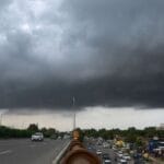
On the quiet morning of Sunday, July 27, 2025, the city of Ahmedabad awoke not to the sound of traffic, but to the relentless patter of monsoon rain hammering rooftops, trees, and pavements. By 10 AM, the South Zone of the city had received a staggering 58.25 mm of rainfall—making it the most rain-drenched zone of the day. The rains arrived with little warning, drenching neighborhoods and flooding streets, while residents scrambled to adjust their Sunday routines.
A Patchwork of Rainfall Across the City
While the South Zone was unquestionably the hardest hit, the Southwest Zone wasn’t far behind, logging 24.5 mm of rain. Sarkhej and Jodhpur recorded substantial individual contributions—29.5 mm and 25.5 mm respectively. Interestingly, Vasna, part of the West Zone, saw 36 mm of precipitation, reflecting how unevenly the showers were distributed.
In contrast, the Northwest, Central, and North Zones escaped relatively lightly, each measuring between 3 mm to 4.5 mm of rainfall. The citywide average came to around 17 mm, but this figure doesn’t reflect the intensity or concentration of the rainfall in specific areas.
The most affected region—South Ahmedabad—includes neighborhoods like Maninagar, which alone received about 39 mm. These numbers underscore the micro-climatic behavior of monsoon systems, often targeting specific zones more heavily than others within the same city.
Disruptions & Infrastructure Response
Though it was a Sunday and major office commutes were off the table, certain underpasses—such as the one at Mithakhali—had to be closed as a precaution. The Ahmedabad Municipal Corporation was quick to act, dispatching pump units and drainage teams to prevent overflow and traffic chaos.
One of the fortunate factors was the timing of the downpour. Had this level of rainfall occurred on a weekday morning, the situation could have been far worse, especially in areas prone to waterlogging and bottlenecked traffic. But Ahmedabad, still fresh from urban drainage upgrades in previous years, managed to avoid full-scale flooding. Nonetheless, the event exposed critical weak points in the city’s stormwater management systems, especially in rapidly urbanizing zones.
Red Alert: Gujarat on High Rainfall Watch
Following the intense rainfall, the India Meteorological Department (IMD) issued red alerts for multiple districts in Gujarat. Apart from Ahmedabad, warnings extended to Gandhinagar, Banaskantha, Mehsana, Sabarkantha, Aravalli, Kheda, and Surendranagar. These alerts warned of very heavy to extremely heavy rainfall, likely to result in surface flooding, swollen rivers, and disrupted transportation.
Ahmedabad, being one of the major urban centers under the alert, remained on high vigilance through the day and into the week. With the peak monsoon season underway, authorities urged citizens to stay updated on forecasts and minimize outdoor travel during storm alerts.
Rainfall Patterns Across Gujarat
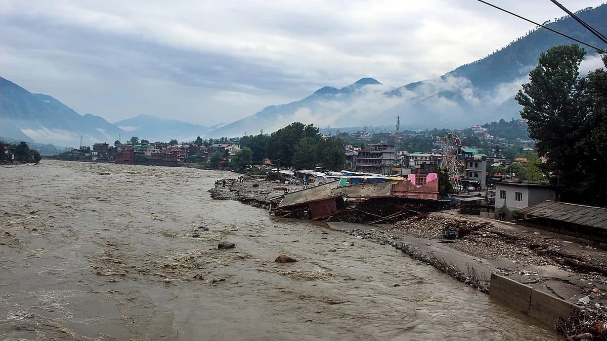
Ahmedabad’s rainstorm is part of a larger weather narrative unfolding across Gujarat. In the past 24 hours, Nandod in Narmada district recorded a whopping 220 mm, while Dahod and Tilakwada reported about 181 mm each. Overall, seven talukas recorded over 100 mm, and 17 others saw rainfall above 50 mm—a sign of vigorous monsoon activity across the state.
Within the broader Ahmedabad district, Dhandhuka reported 58 mm, Viramgam 52 mm, and Sanand about 24 mm. These scattered yet significant showers indicate that intra-district variation in rainfall is very much a reality, shaped by geography, wind direction, and cloud mass convergence.
Forecast: More Rain on the Horizon?
According to meteorological projections, the next few days in Ahmedabad are expected to remain cloudy, with periodic showers and mild temperatures between 26°C and 32°C. Though the rainfall might be intermittent, it may bring localized heavy spells, especially during the evening or early morning hours.
The IMD has signaled that central and southern Gujarat will remain under close observation, with chances of extended rainfall stretching into early August. The combination of moist easterly winds and low-pressure systems could trigger more such cloudbursts in quick succession.
Practical Tips for Residents and Authorities
For Citizens:
- Avoid venturing through underpasses or low-lying roads, especially when it’s raining heavily.
- Stay tuned to weather bulletins and pay attention to red/yellow alerts specific to your district.
- Drive cautiously and avoid parking vehicles near old trees or vulnerable power lines.
- Ensure that electronic devices and documents are kept safe in case of water seepage.
For Civic Bodies:
- Focus on clearing drainage choke points, particularly in the southern and western parts of the city.
- Maintain regular inspection of urban flood-prone areas, even if water levels recede.
- Set up emergency communication hotlines and mobile updates for localized flash flood alerts.
- Monitor water reservoirs and embankments closely to prepare for any overflow scenarios.
Why Was South Ahmedabad Hit So Hard?
The stark difference in rainfall between Ahmedabad’s zones raises an important question—why did the South Zone bear the brunt? Meteorologists point to a mix of urban heat dynamics, cloud density, and topographical alignment with monsoon wind paths. The Southwest monsoon winds, carrying moisture from the Arabian Sea, often hit southern districts first. These air masses condense rapidly when they encounter city heat and elevation shifts, causing concentrated rainfall.
Moreover, the rapid urbanization of areas like Maninagar, Jodhpur, and Sarkhej has created sprawling heat islands that further amplify localized cloudbursts. The combination of natural and man-made factors made the southern region the ideal ‘landing zone’ for this rain system.
Is 58 mm a Lot?
In isolation, 58.25 mm in a few hours is substantial—but not catastrophic. During previous extreme events like Cyclone Asna in 2024, certain districts in Gujarat recorded over 200 mm in a single day, leading to flash floods and damage. In 2017, Ahmedabad and surrounding cities faced prolonged flooding that displaced thousands.
However, what makes the recent downpour notable is its intensity over a short duration, and its zone-specific impact. It underscores how even a seemingly moderate rainfall can test the preparedness of municipal systems, especially when combined with poor drainage and urban sprawl.
Final Thoughts: A Timely Wake-Up Call
The rains of July 27 serve as more than just another monsoon update—they are a reminder. A reminder of how quickly conditions can change, how vulnerable parts of a thriving metropolis remain, and how important preparedness and infrastructure investment continue to be.
For citizens, this is a moment to reevaluate personal safety and planning during monsoon. For city authorities, it’s a call to fine-tune flood response protocols and enhance smart weather communication. Ahmedabad may have weathered this rain well, but with more showers on the horizon, it’s not the time to relax.
As the monsoon continues to roll across Gujarat, the lesson is clear: stay alert, stay informed, and always respect the power of nature.